|

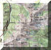
 Denver
Front Range/South Platte Denver
Front Range/South Platte
Just
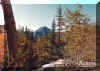
West of Denver, the foothills merge with the front range. While
these are not the most impressive peaks in the Colorado Rockies,
they've been a special part of Eddie's life. Several of the peaks
and unnamed "bumps" in the region were summited as part
of rock climbing or just afternoon wandering.
|
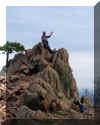
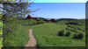
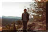
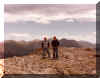
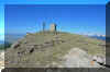
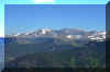
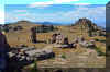
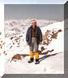
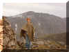
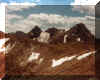
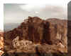
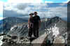
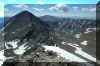
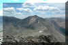
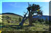
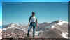
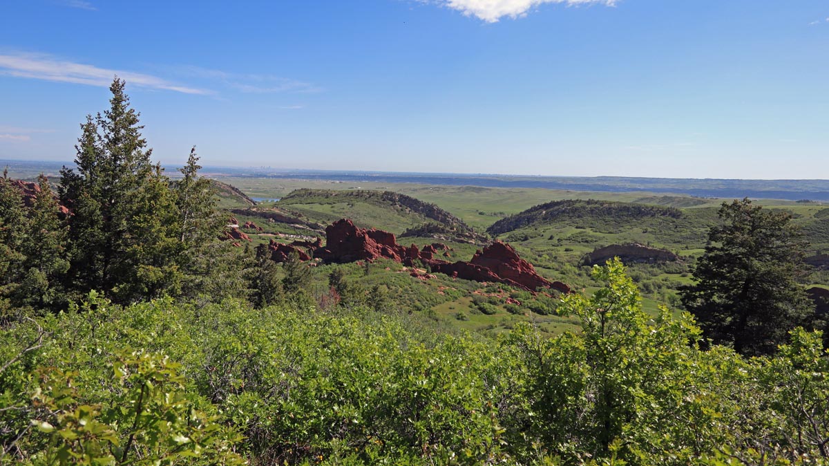
 Mt.
Morrison - 7,884 ft / 2403 m elevation
Mt.
Morrison - 7,884 ft / 2403 m elevation
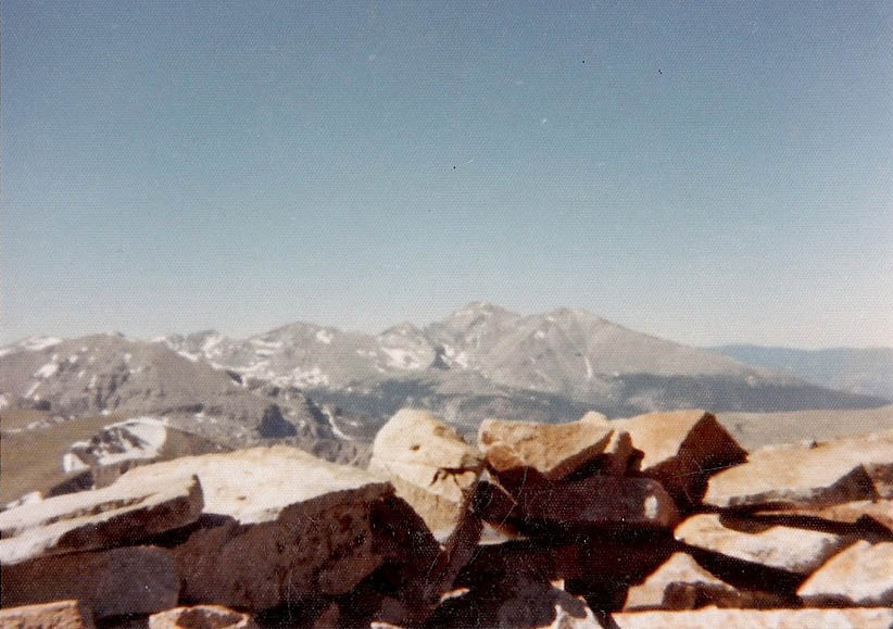
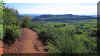
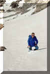
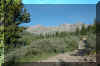
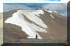
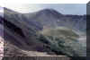
This peak rises from the famous Red Rocks amphitheater. On the slopes
of Mt. Morrison, Eddie received his first rock climbing instruction
from his close friend, Steve Solon. This is an afternoon trail that
has to be one of the greatest spots to watch the sun set on Denver.
First climbed 1982 |
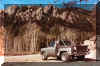
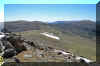
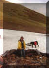
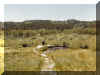
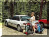
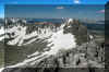
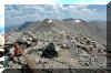
 The
Red Rocks parking lot where the hike starts. Eddie's Datsun PU can
be seen in the lot. The
Red Rocks parking lot where the hike starts. Eddie's Datsun PU can
be seen in the lot. |
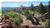
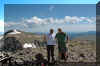
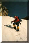
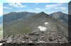
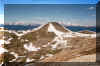
 Half
way to the summit. Half
way to the summit. |
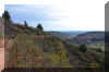
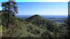
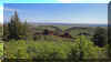
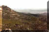
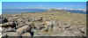
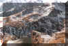
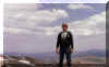
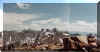
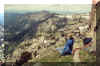
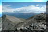
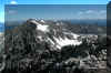
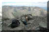
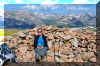
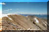
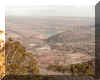 The
view of the city of Morrison from the summit. The
view of the city of Morrison from the summit. |
|
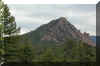
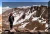
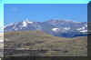
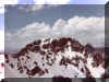
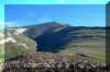
Bald
Mtn. - 7,881 ft / 2402 m elevation and True
Mtn. - 7,784 ft / 2372 m elevation
These 2 peaks are on private property with limited access. Due to
the access restrictions, short hikes and poor trail, I would not
recommend the effort to bag these peaks. That said, Bald Mountain
is the high point on the Palmer divide that separates the Platte
River and Arkansas basins, so it might be a nice check in the peak
bagging.
Climbed
both with the CMC 2/22/2020
|
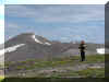
 Looking
at True Mtn while hiking on Bald Mtn.. Looking
at True Mtn while hiking on Bald Mtn.. |
 Looking
at Bald Mtn. from the summit of True Mtn. Looking
at Bald Mtn. from the summit of True Mtn. |
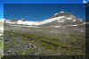
 Looking
north down the I25 corridor toward Castle Rock from True Mtn. Looking
north down the I25 corridor toward Castle Rock from True Mtn. |
|
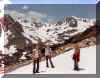
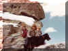
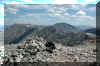
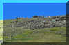
Plymouth
- 7,295 ft / 2224 m elevation and Bill
Couch- 7,082 ft / 2159 m elevation
Both
of these peaks are primarily accessed through Deer Creek Canyon
Park. This can be a VERY busy park on most summer days. Early start
is recommended.
Climbed
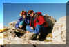
Plymouth with Sheena Juli and ? 4/23/2017
Climbed
Solo 6/5/2019
|
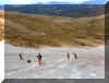
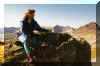
 On
the trail. June 2019 was one of the greenest springs I have ever seen
in the front range! On
the trail. June 2019 was one of the greenest springs I have ever seen
in the front range! |
 On
the trail with Sheena and Juli in 2017. On
the trail with Sheena and Juli in 2017. |
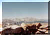
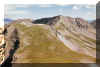
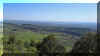 Looking
at the Denver skyline. Looking
at the Denver skyline. |
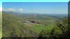 Looking
back at the Lockheed Martin Deer Creek facility from the trail. Looking
back at the Lockheed Martin Deer Creek facility from the trail. |
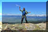
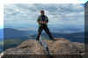
 Eddie on the summit rock pile of Plymouth - 2017.
 |
 Looking at Bill Couch on the approach.
 |
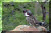 A male Blue Grouse along the trail.
 |
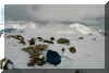
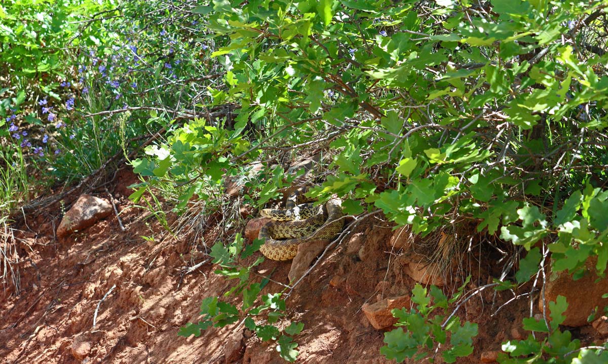
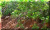 A little extra wildlife along the trail that gets a bit more attention
and caution. This was one very annoyed rattle snake.
A little extra wildlife along the trail that gets a bit more attention
and caution. This was one very annoyed rattle snake. |
|
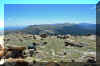
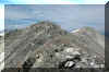
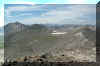
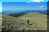
Carpenter
Peak- 7,166 ft / 2184 m elevation
This
peak is accessed primarily through Roxburough State Park. Another
beautiful front range trail that was incredibly green in the spring
of 2019.
Climbed
Solo 6/3/2019
|
 On
the trail. On
the trail. |
 Looking
down on the red rocks that the park is known for. Looking
down on the red rocks that the park is known for. |
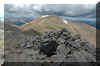
 On
the summit. On
the summit. |
|
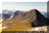
Berrian
Mountain - 9,151 ft / 2789 m elevation
Rising up behind Aspen Park to the north of H285, is the prominent
mountain. It's skirted on the south and east by Eagle Cliffs. This
is where Eddie began climbing in earnest. Amongst the cliffs are
many old routes that still contain pitons from the original climbers
in the area. See the Climbing
page for more info. Most of Eddie's time here was in the 80's. In
the 90's, private property closed access (ass holes)!
|
 Eagle
Cliffs and Berrian Mtn from the parking lot. Jim Wedeman let Eddie
borrow his truck for the day. Eagle
Cliffs and Berrian Mtn from the parking lot. Jim Wedeman let Eddie
borrow his truck for the day. |
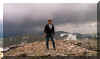
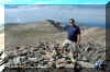
 Eddie at the summit
 |
 The view from the summit. Haze is hiding Denver.
 |
|
Raleigh
Peak - 8,185 ft / 2495 m elevation
This is the central peak of the Top-of-the-World area. Eddie climbed
this a few time while rock climbing in the area.
|
 A
great view of the peak from the Colorado Trail. A
great view of the peak from the Colorado Trail. |
|
|
|
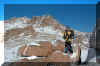
Mt. Anne - 7,936ft / 2419 m elevation
This is an unlisted peak (not named on maps) in the South Platte
area just outside of Buffalo Creek. Hiked this 10.5 RT on 5/1/2021
with the CMC. There is actually a summit register! Well worth the
off-trail effort.
|
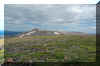
 On
the approach through the Buffalo Creek burn scar. Mt. Anne is the
peak in the middle. The route followed the ridge over the left point. On
the approach through the Buffalo Creek burn scar. Mt. Anne is the
peak in the middle. The route followed the ridge over the left point. |
 The
CMC group making the final scramble to the summit The
CMC group making the final scramble to the summit |
 Eddie
on the official summit with Top-of-the-World behind to the left. Eddie
on the official summit with Top-of-the-World behind to the left. |
|
Lions
Head - 9,463 ft / 2884 m elevation
Part of a great 12 mile RT hike in Staunton State Park. Hiked this
with Nate on 9/22/2020.
|
 Lions
Head from the upper trail. Lions
Head from the upper trail. |
 View
from the summit. View
from the summit. |
|
|
Mount
Evans Region
A
little further west of Denver, this region was accessible from Eddie's
first house in about 45 minutes making it a great region to visit.
With four 14'ers and a few other peaks we've spent plenty of time
here. Eddie has hiked Mt. Bierstadt over 20 times (see the fourteeners
page). Most of these trips done while getting ready to climb Mt.
Denali.
|
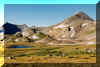
Mt.
Edwards - 13,850 ft / 4221 m elevation, 83rd highest
This peak shares the ridge line with the 14ers Grays and Torreys.
It sits just 1.3 miles east of Torreys. The views from the summit
are wonderful. Eddie climbed this on 7/1/2011. |
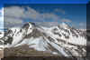
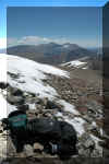 On the summit looking at Mt. Bierstadt and Mt. Evans.
 |
 Looking over at Torreys (L) and Grays (R).
 |
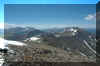 This is an awesome view of the Mt. Evans group. From L to R, Gray
Wolf is on the edge of the photo, Spalding, Evans, Bierstadt, and
Square Top.
This is an awesome view of the Mt. Evans group. From L to R, Gray
Wolf is on the edge of the photo, Spalding, Evans, Bierstadt, and
Square Top. |
|
Square
Top Peak - 13,794 ft / 4204 m elevation, 111th highest
The views from Mt. Bierstadt make the summit look impressive. However,
the summit is long and flat. Hard to find the actual high point.
Need to scan a better image of the peak.
|
 South
West of Guennella Pass on the slopes of the Square Top. Sheena and
Eddie had a great view of Mt. Bierstadt and Mt. Evans in the background. South
West of Guennella Pass on the slopes of the Square Top. Sheena and
Eddie had a great view of Mt. Bierstadt and Mt. Evans in the background.
|
 Parking lot on Guennella pass with Square Top behind. Ken Garcia and
Shannon in front of "The Buick"
Parking lot on Guennella pass with Square Top behind. Ken Garcia and
Shannon in front of "The Buick" |
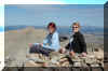
 Shannon (?) and Eddie on the summit of Square Top - Sept 1982
 |
Mt. Spalding - 13,842 ft / 4219 m elevation, 84.5 Highest
The first time Eddie hiked Spalding was on a winter hike in an early
snow storm in September 1979. Eddie hiked it again while making the
Bierstadt, Saw Tooth, Evans, Spalding loop in 1985. |
 This
is the 2nd time Eddie climbed Mt. Spalding while doing the Bierstadt
- Evans - Spalding loop. This
is the 2nd time Eddie climbed Mt. Spalding while doing the Bierstadt
- Evans - Spalding loop. |
|
|
Gray Wolf Mountain - 13,602 ft / 4146 m elevation, 190th Highest
The first time Eddie hiked Gray Wolf was purely by accident. Heading
up in a fall snow storm, headed for Mt. Evans, he wound up going up
Gray Wolf first. Back down into the clouds and then up another slope
found him on top of Mt. Spalding. Due to continuing snow, he erred
on the side of good judgment and headed back to Guennella pass and
home.
|
Need to find one of the better photos to scan. |
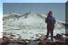
 Looking toward Mt. Evans from the summit of Gray Wolf Peak (13,602
ft). This was the only break in the clouds - Sept 79
Looking toward Mt. Evans from the summit of Gray Wolf Peak (13,602
ft). This was the only break in the clouds - Sept 79 |
|
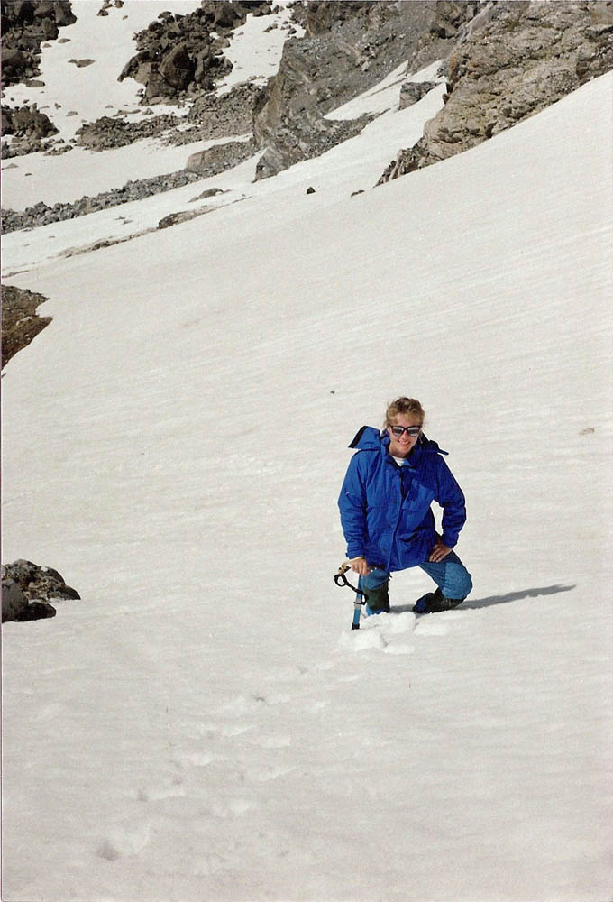
Cupid Peak - 13,117 ft / 3998m elevation, 555th Highest
Just east of Loveland Pass sits Cupid peak. In May 1998, Eddie hoped
to climb Grizzly
Peak as a last haike before moving to Germany and the first peak
since breaking his back. As luck would have it, weather and snow stopped
him on the summit of a peak he didn't know even had a name.
|
 A
view north from the summit. A
view north from the summit. |
 On the summit
 |
 Eddie on the summit.
 |
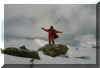
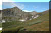
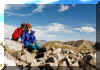
Chief Mountain - 11,709 ft / 3569m elevation
A great short hike with Nate on 11/19/2020. Could have used my micro
spikes due to the heavily used trail..
|
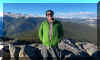 Eddie
on the summit. Eddie
on the summit. |
|
|
|
Kenosha/Tarryall
Ranges
Just
south of Kenosha Pass on highway 285 lies the much over looked ranges
of South Platte, Kenosha and Tarryall ranges. While these ranges
don't sport any of the high peaks (the highest is 12,431), they
make for a fast enjoyable getaway from the hustle and bustle of
Denver. Just about all of this area is located in the Lost Creek
Wilderness area and parallels the South Platte river.
|
North
Twin Cone - 12,323 ft elevation
This peak anchors the north end of the range and has good year round
access from Kenosha Pass. Because of the heavy 4 wheel drive use in
the summer, it is best hiked in the winter. Eddie climbed this on
6/13/2014. |
 Eddie on the summit of North Twin Cone.
 |
 The radio tower that keeps this summit out of the wilderness area.
 |
 A view of North Twin Cone from Mt. Blaine.
 |
|
Mount Blaine
- 12,303
ft elevation
This peak is a small very rocky bump straight east of North Twin
Cone. Eddie climbed this on 6/13/2014. A VERY windy day.
|
 Eddie on the summit of Mt. Blaine trying to stand up in the wind.
This is just below the summit, but couldn't get the actual summit
photo by himself.
Eddie on the summit of Mt. Blaine trying to stand up in the wind.
This is just below the summit, but couldn't get the actual summit
photo by himself. |
 Looking at Mt. Blaine from the summit of North Twin Cone.
 |
 Mt. Bierstadt (L) and Mt. Evans (R) from the summit of Blaine.
 |
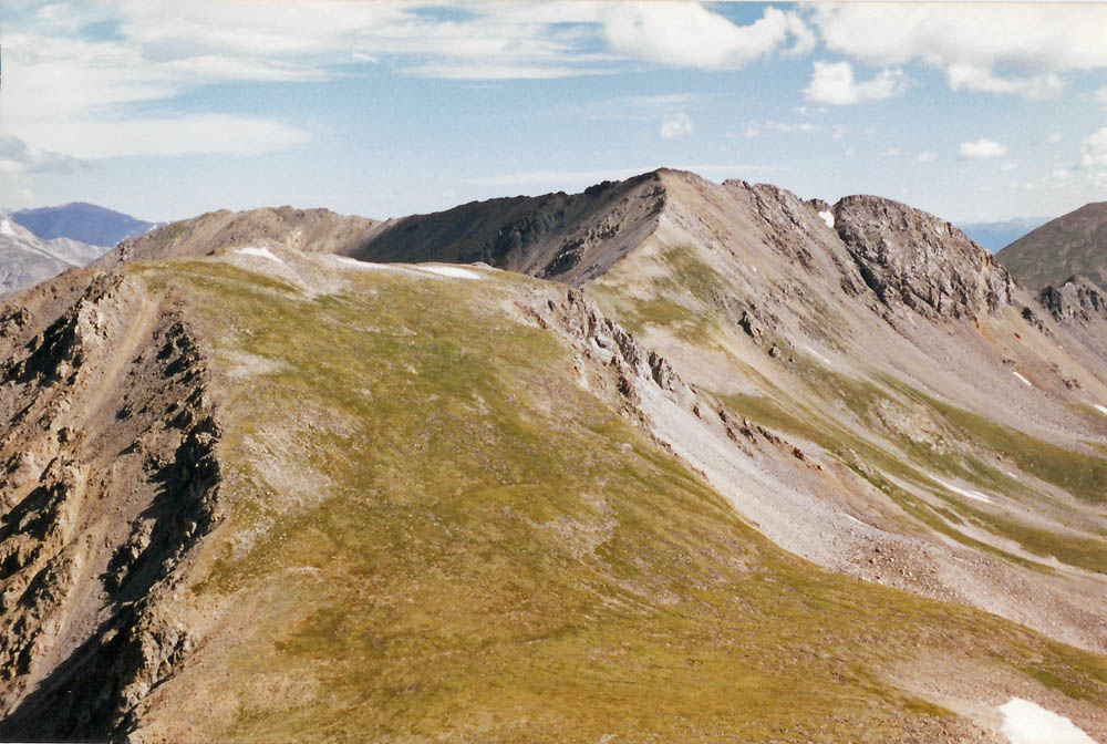
South Twin Cone - 12,340 ft elevation
This peak is the highest peak in the north end of the range. It's
beautiful cone shaped summit can be seen from South Park. Eddie climbed
this on 6/13/2014. A VERY windy day! |
 Eddie on the summit of South Twin Cone.
 |
 Looking south along the range from the summit of South Twin Cone
 |
 Looking over Mt. Blaine at Mt. Bierstadt (L) and Mt. Evans (R) from
the summit of South Twin Cone.
Looking over Mt. Blaine at Mt. Bierstadt (L) and Mt. Evans (R) from
the summit of South Twin Cone. |
|
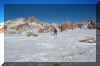
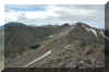
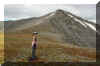
Bison
Peak - 12,431 ft /3789 m elevation
This peak is perhaps the most spectacular peak in the Tarryall range
and has a spectacular rocky summit plateau.
Eddie
first attempted this peak with Andy Westmeyer on 1/27/2013. But
due to snow and wind, the summit wasn't reached.
On September
14, 2014, Eddie and Sheena summited the peak.
|
 Eddie in the snow, wind and cold with the summit behind.
 |
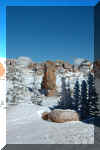 Some of the spectacular rock formations on the summit plateau.
 |
 Andy Westmeyer in the snow with the summit behind.
 |
 Just above timberline, the valley where the trails starts can just
be seen in the right. Sheena can also be seen coming up the trail.
Just above timberline, the valley where the trails starts can just
be seen in the right. Sheena can also be seen coming up the trail. |
 The spectacular rock formations as seen from the trail not far from
the summit.
The spectacular rock formations as seen from the trail not far from
the summit. |
 Eddie on the summit rocks
 |
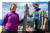 Eddie and Sheena on the summit.
 |
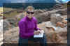 Sheena signing the summit register.
 |
|
James
Peak Region/Wilderness Area
Just
West of Denver, this is another region that is very accessible from
Denver. The James Peak Wilderness area is the continental divide
section between the Indian Peaks to the north and Berthoud Pass
to the southwest. Before becoming a separate wilderness area, this
area was sometimes considered part of the Indian Peaks area.
|
James
Peak - 13,294 ft / 4052 m elevation, 405h highest
James Peak is the 5th highest summit in the range. Eddie has summited
this peak over 5 times. |
 |
 One of Eddie's favorite pastimes was to fly over many of the
peaks he spent time hiking around. This is an aerial view of James
Peak from the south with Ice Lake below.
One of Eddie's favorite pastimes was to fly over many of the
peaks he spent time hiking around. This is an aerial view of James
Peak from the south with Ice Lake below. |
 A
view of James Peak from the summit of Mt. Bancroft. A
view of James Peak from the summit of Mt. Bancroft. |
 Eddie on the summit of James Peak (13,294 ft) with Leslie Sly - July
1981
Eddie on the summit of James Peak (13,294 ft) with Leslie Sly - July
1981 |
 A 1984 winter accent of James Peak with Dick Stone.
 |
 Glissading down a snow field just below the summit.
 |
 Eddie at the top of St. Mary's Glacier. Not much left as we approach
2020. This used to be a large enough snow field/glacier that you could
ski it all year round.
Eddie at the top of St. Mary's Glacier. Not much left as we approach
2020. This used to be a large enough snow field/glacier that you could
ski it all year round. |
|
|
Mt.
Bancroft - 13,250 ft / 4039 m elevation
This
is the 8th highest summit in the Indian Peaks. Eddie has summited
this peak probably over 10 times.
|
 In this aerial view from the north east looking at the snow capped
Mt. Bancroft and all 5 lakes below. Mt. Parry can be seen behind Mt.
Bancroft at the top edge of the image.
In this aerial view from the north east looking at the snow capped
Mt. Bancroft and all 5 lakes below. Mt. Parry can be seen behind Mt.
Bancroft at the top edge of the image. |
 On the summit of Mt. Bancroft.
 |
 Eddie and Bob Griffith on the summit July 2011. This was Bob's 1st
summit.
Eddie and Bob Griffith on the summit July 2011. This was Bob's 1st
summit. |
|
Parry
Peak - 13,391 ft / 4082 m elevation,
324th highest
This
is the highest peak in the James Peak group. Parry Peak is often
considered the parent peak to Mt. Bancroft. Eddie has summited this
peak less than 10 times.
|
 On the summit with the storms coming in.
 |
 A view of Parry Peak from the summit of Mt. Bancroft.
 |
|
Mt.
Eva - 13,130 ft / 4002 m elevation
Eddie
has summited this peak only a couple times.
|
 A view of Eva from the trail/road to Lock Lomond. Eddie climbed the
ridge between the sun and shadow.
A view of Eva from the trail/road to Lock Lomond. Eddie climbed the
ridge between the sun and shadow. |
Still need to scan the summiting photos. |
|
|
Indian
Peaks Region/Wilderness Area
Just
West of Boulder, is the area that Eddie cut his hiking teeth on.
This area encompasses a large area to the south of Rocky Mountain
National Park. The peaks range from 11,000 to 13,000 feet - no 14'ers.
Today it has been designated as a Wilderness area, protecting it
for future generations to enjoy as much as I have. The most popular
aspect of the area is the St. Marys Glacier. Although the glacier
is getting smaller each year, it used to be a popular ski area with
good access to Denver. Below are some of my hikes in the area.
|
South
Arapaho Peak - 13,397 ft elevation This was the first
mountain Eddie ever climbed that was above timberline. Dad H. took
all three of us up the peak and we had a great time. I was hooked!
|
 Eddies 1st peak. South Arapaho Peak in the Indian peaks area. Left
to Right - Eddie, Marion, Juli
Eddies 1st peak. South Arapaho Peak in the Indian peaks area. Left
to Right - Eddie, Marion, Juli |
 Last
push for the summit of So. Arapaho - June 74 Last
push for the summit of So. Arapaho - June 74 |
 North Arapaho from the South.
 |
 Eddies 1st summit - South Arapaho Peak (13,397ft). Left to Right -
Juli, Marion, Eddie and Barney - June 74
Eddies 1st summit - South Arapaho Peak (13,397ft). Left to Right -
Juli, Marion, Eddie and Barney - June 74 |
|
|
|
|
Mt.
Audubon - 13,221 ft / 4030 m elevation Eddie climbed
this peak from Camp Tahosa while at scout camp.
|
 The Trail head from the Boy Scout camp - Camp Tahosa in the Indian
peaks area.
The Trail head from the Boy Scout camp - Camp Tahosa in the Indian
peaks area. |
 Indian peaks range from the summit of Mt. Audubon (13233 ft) - July
74. Eddies 2nd summit
Indian peaks range from the summit of Mt. Audubon (13233 ft) - July
74. Eddies 2nd summit |
 Looking toward Longs Peak from the summit of Mt. Audubon
 |
 Sliding down the arrowhead glacier on Mt. Audubon
 |
|
|
|
|
Mt.
Sawtooth - 12,304 ft / 3750m elevation This was always
a fun peak to climb. Eddie did it at least 3 times.
|
 Eddie on the summit of Sawtooth (12304 ft) in the Indian Peaks - Aug
1982 with Ken Garcia
Eddie on the summit of Sawtooth (12304 ft) in the Indian Peaks - Aug
1982 with Ken Garcia |
|
|
Mt.
Elktooth - 12,484 ft / 3916m elevation This was Eddie's
dream peak for the longest time. He tried to summit twice and was
turned around by weather. On the 3rd try in spring of 1992 Sheena
and Eddie successfully summitted the peak!
|
 Eddie's 1st good view of Mt. Elk Tooth in the Indian peaks St. Vrain
valley - 1981
Eddie's 1st good view of Mt. Elk Tooth in the Indian peaks St. Vrain
valley - 1981 |
 Eddie on the Middle St. Vrain trail with our destination in the background
- Elktooth.
Eddie on the Middle St. Vrain trail with our destination in the background
- Elktooth. |
 Some SERIOUS talus getting to the base of Elktooth
 |
 Sheena climbing the snow coulier on Elktooth
 |
 Eddie climbing the snow coulier on Elktooth
 |
 Eddie and Sheena on the summit of Elktooth (12848 ft) in the Indian
peaks area.
Eddie and Sheena on the summit of Elktooth (12848 ft) in the Indian
peaks area. |
 Back to the car after a beautiful success on Elktooth.
 |
|
Pawnee
Peak - 12,943 ft / 3945 m elevation Hiked with the
Colorado Mountain Club. 8/23/2022
|
 On the hike past Long Lake.
 |
 Eddie
on Pawnee Pass. Pawnee Peak summit is on the left. Eddie
on Pawnee Pass. Pawnee Peak summit is on the left. |
 The
CMC group on the summit. Shoshoni, Navajo and Apache peaks can be
seen behind the group. The
CMC group on the summit. Shoshoni, Navajo and Apache peaks can be
seen behind the group. |
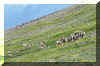
Shoshoni
Peak - 12,967 ft / 3952 m elevation Hiked with Dad,
Juli, Kelly Thomas, Leslie Sly, and Barney (dog). Barney injured his
paws and we had to carry him down. 8/5/81
|
 Kelly Thomas coming up the trail toward Pawnee Pass
 |
 Looking along the ridge toward Navajo (L) and Apache (R). Shoshoni
is just out of the photo to the left.
Looking along the ridge toward Navajo (L) and Apache (R). Shoshoni
is just out of the photo to the left. |
 The summit of Shoshoni.
 |
Hiamovi
Tower (Spire) - 12,220 ft elevation
This was supposed to be one of those hard-core climbing weekends.
Eddie and Sheena backpacked into Hell Valley and set up camp. The
plan was to climb 3 peaks starting with Hiamovi Spire. As usual, Eddie
got off route on the 4th pitch and it became much harder. Then the
worst happened, while Sheena was leading a rotten pitch, the rock
broke loose and she took a bad fall, fracturing her ankle. Two days
hiking out (Sheena refused rescue) and 2 surgeries to her ankle and
all was well again.
|
 Eddie leading a 5.6 section on Hiamovi spire.
 |
 Sheena following the technical route on Hiamovi Spire in the Indian
Peaks wilderness.
Sheena following the technical route on Hiamovi Spire in the Indian
Peaks wilderness. |
 This route was ONLY supposed to be 5.6. NOT overhanging 5.9! Eddie
checking the guide book on a belay ledge.
This route was ONLY supposed to be 5.6. NOT overhanging 5.9! Eddie
checking the guide book on a belay ledge. |
 Sheena after the fateful fall that broke her ankle on Hiamovi Spire
(12,220 ft) in the Indian peaks area.
Sheena after the fateful fall that broke her ankle on Hiamovi Spire
(12,220 ft) in the Indian peaks area. |
|
|
|
|
|
Ten
Mile - Mosquito Range
This
range runs from Frisco/I70 at the north end to the continental divide/Hoosier
(Ten Mile Range), and from there south to Highway 285 at Trout Creek
Pass (Mosquito Range). This is a range of broad rounded summits
and a handful of 14ers. However, the sheer number of 13ers and accessibility
from Denver make this a great range to play in. The following list
is organized from north to south.
|
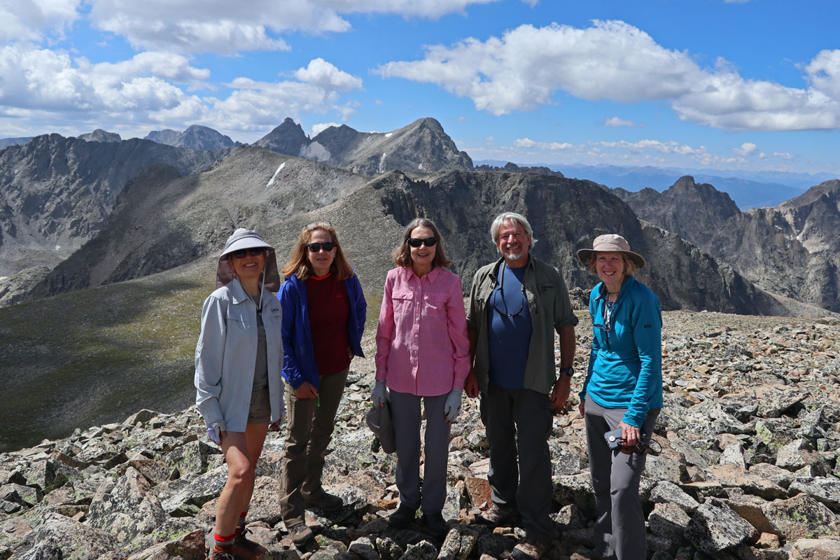
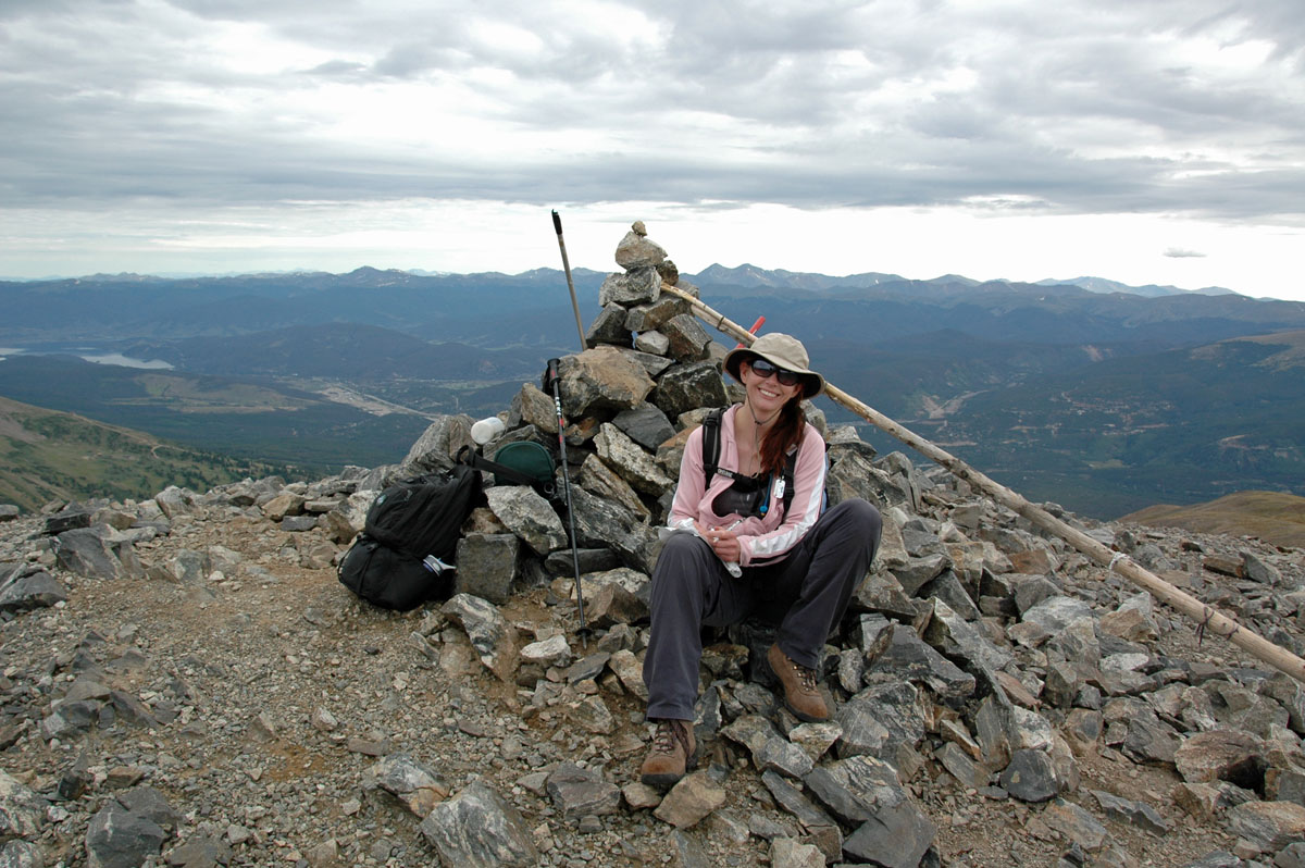
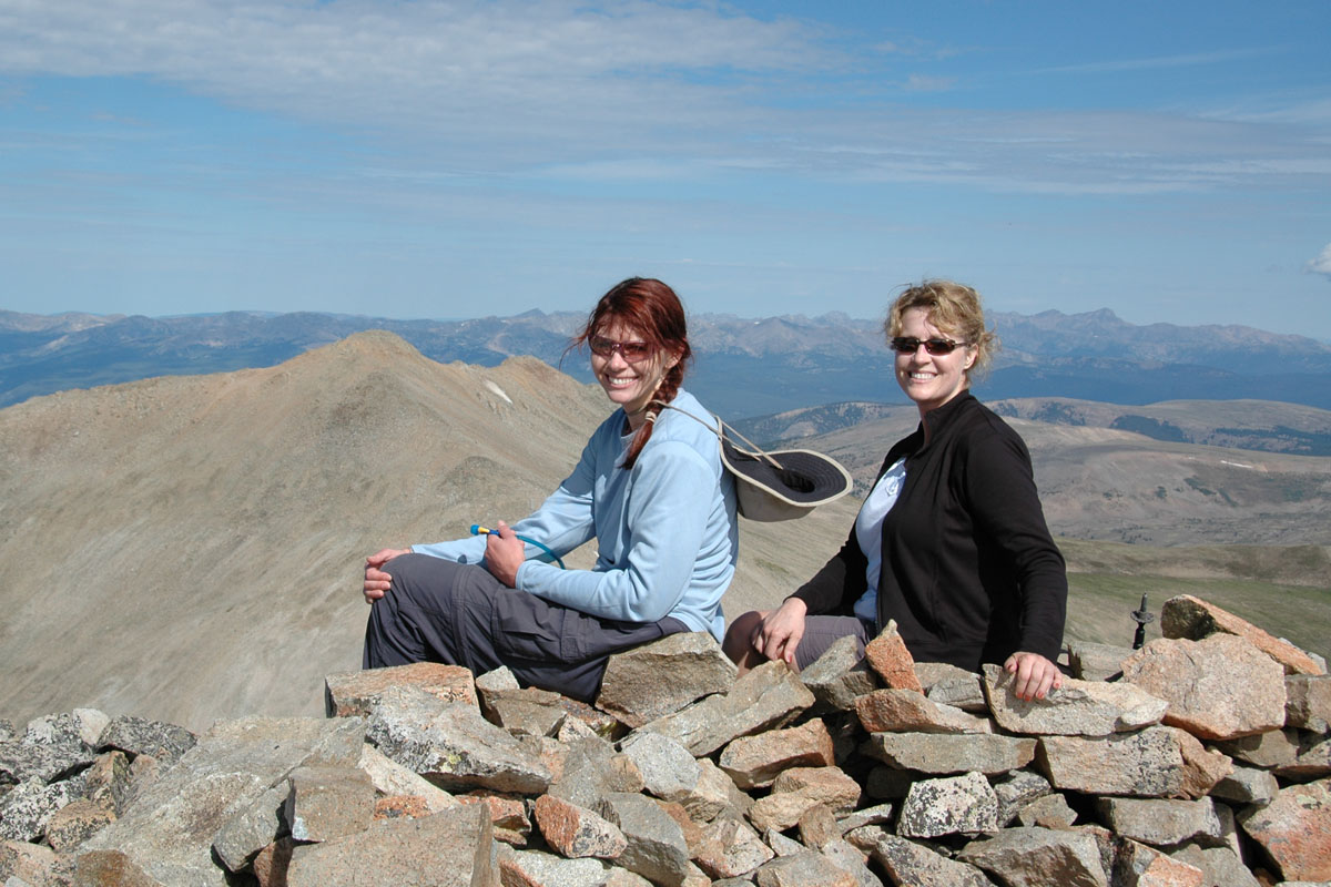
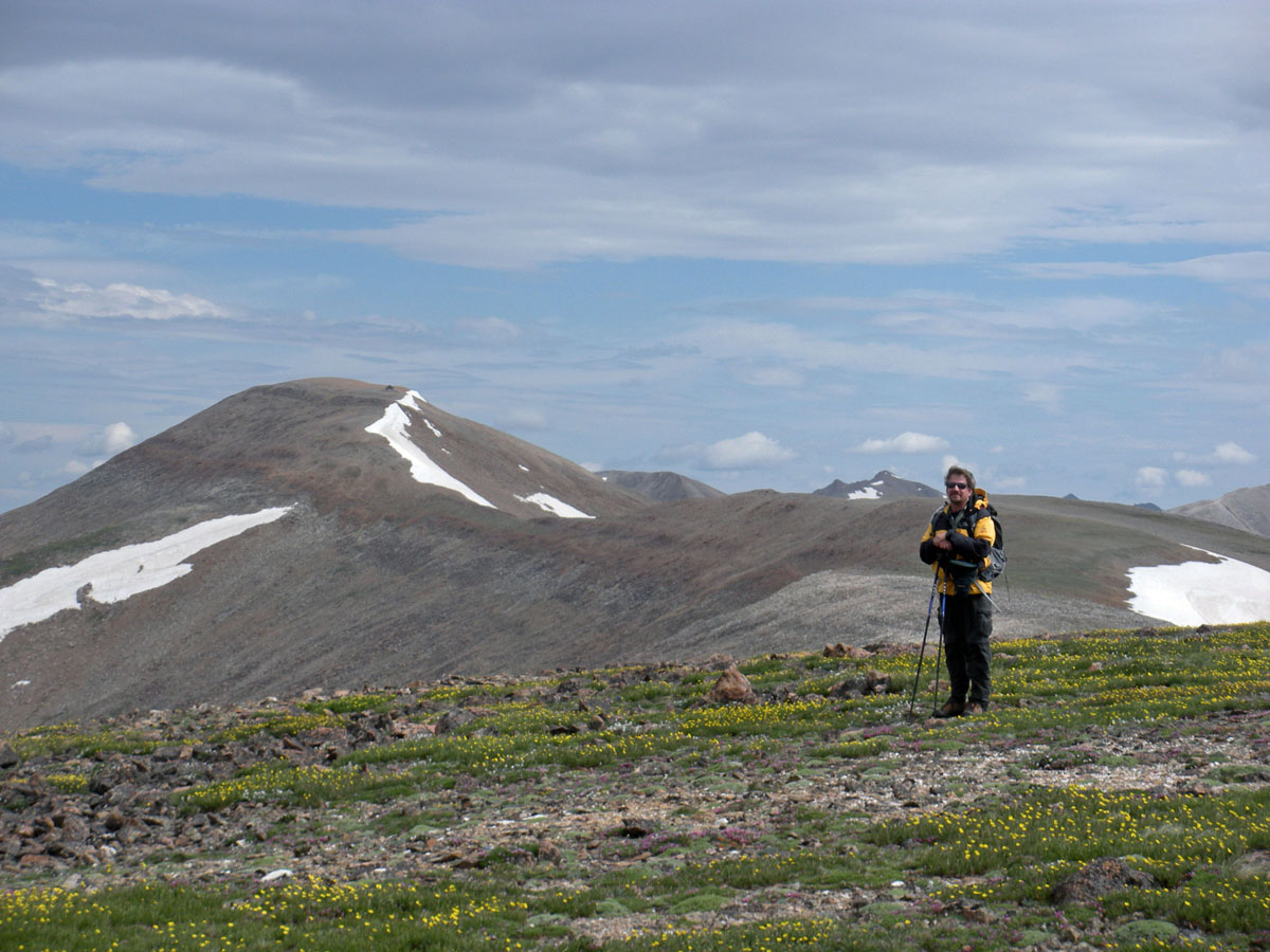
Peak 5 - 12,855 ft
elevation
While hiking segment 7 of the Colorado Trail, Sheena, Juli Cooley
and Lisa Peterson took a break at the saddle between Cooper Mountain
Ski Resort and Gold Hill (near Breckenridge), Eddie took off and climbed
Peak 5. 9/27/2014 |
 Looking
toward the peak, Eddie wasn't sure which bump was the official summit. Looking
toward the peak, Eddie wasn't sure which bump was the official summit. |
 So he did both bumps and took photos to make sure. Peak 4 can be seen
along the ridge to the left.
So he did both bumps and took photos to make sure. Peak 4 can be seen
along the ridge to the left. |
 A
fellow hiker sharing the mountain... A
fellow hiker sharing the mountain... |
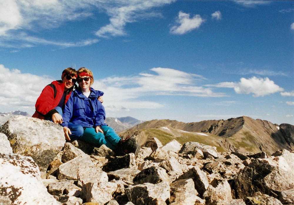
Peak
10 - 13,633 ft /4155 m elevation,
178th highest
A fun excursion on the way up Crystal Peak. Eddie climbed this with
Suzanna Koeller on 8/26/2011 |
 Suzanna Koeller approaching the summit of Peak 10
 |
 Suzanna signing the summit register on Peak 10.
 |
 Eddie on the summit of Peak 10 - thus the 10 fingers.
 |
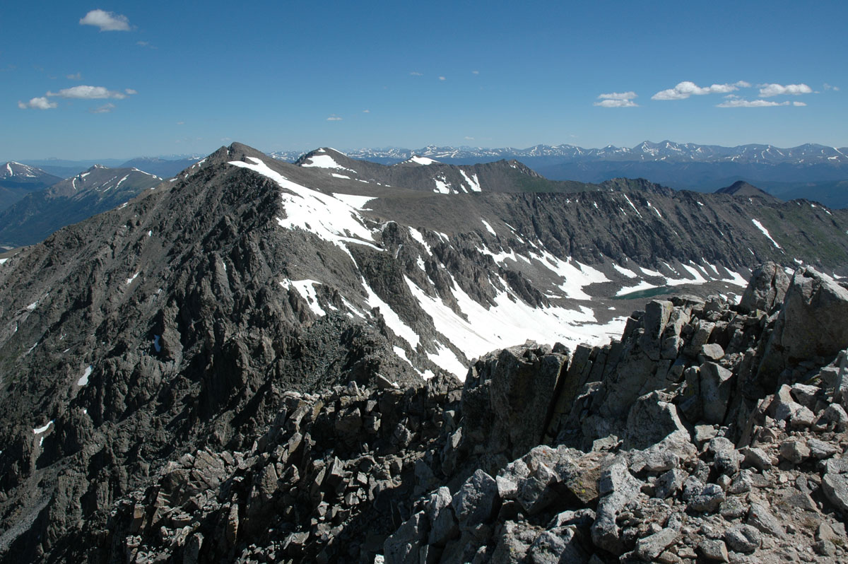
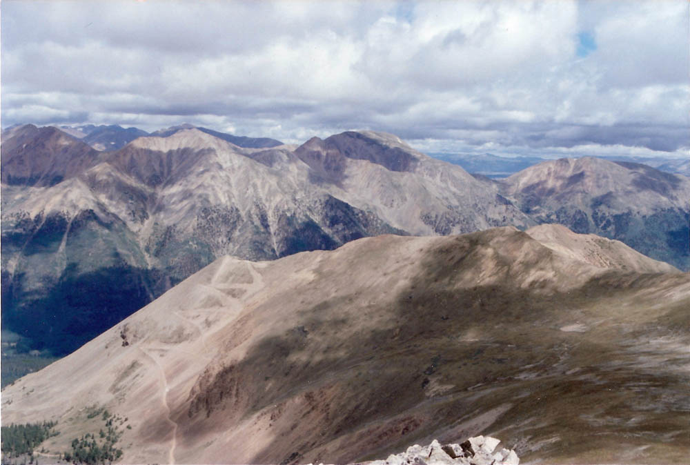
Crystal
Peak - 13,852 ft /4222 m elevation,
82nd highest
This peak anchors the north end of the 10 Mile range. Eddie climbed
this with Suzanna Koeller on 8/26/2011 |
 Crystal Peak at the end of the valley.
 |
 Suzanna on the saddle between Peak 10 and Crystal in the background.
 |
 Looking south from the summit. Quandary (L) and Pacific (R) with several
in between that Eddie has climbed.
Looking south from the summit. Quandary (L) and Pacific (R) with several
in between that Eddie has climbed. |
 Suzanna and Eddie on the summit of Crystal.
 |
 Suzanna on the summit of Crystal with Peak 10 on the left. They had
just come from Peak 10.
Suzanna on the summit of Crystal with Peak 10 on the left. They had
just come from Peak 10. |
|
|
|
|
Pacific
Peak -
13,950ft /4252 m elevation, 61st highest To be climbed |
 Looking at Pacific from Crystal. Note the 2 climbers approaching the
summit.
Looking at Pacific from Crystal. Note the 2 climbers approaching the
summit. |
|
|
|
Atlantic
Peak -
13,841 ft /4219 m elevation, 86th highest To be climbed |
|
|
|
Fletcher
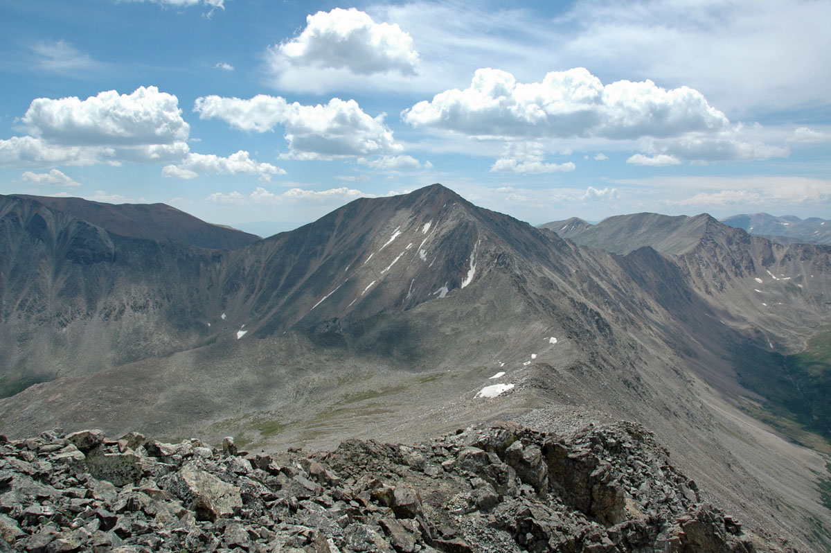
Mountain - 13,951 ft /4252 m elevation,
59th highest
This peak is the highest in the range. It lies just 1.2 miles west
of
Mt. Quandary. The two can be climbed together making for a great
day. Eddie climbed this on 7/15/2011 |
 A cute marmot watching me as Eddie begins his hike.
 |
 A view of the summit (R) from just above the snow fields. Drift Peak
can be seen on the left.
A view of the summit (R) from just above the snow fields. Drift Peak
can be seen on the left. |
 The west ridge of Quandary (14,265') from the summit of Fletcher.
You can see the trail leading to the summit.
The west ridge of Quandary (14,265') from the summit of Fletcher.
You can see the trail leading to the summit. |
 Looking south at Drift Peak (13,900') from the summit. A bit too much
snow to attempt without an ice ax and ridged boots.
Looking south at Drift Peak (13,900') from the summit. A bit too much
snow to attempt without an ice ax and ridged boots. |
 Looking north from the summit at Atlantic (low), Pacific (with notch),
Crystal, Peak 10 and Father Dyer Peak.
Looking north from the summit at Atlantic (low), Pacific (with notch),
Crystal, Peak 10 and Father Dyer Peak. |
 Eddie on the summit of Fletcher with Quandary behind.
 |
|
|
Clinton
Peak - 13,857 ft /4224 m elevation,
80th highest
This peak was the 1st of three peaks for the day. Clinton has the
distinct position of sitting on the continental divide, straddling
both the Ten Mile and Mosquito ranges. Eddie climbed this 3 peak circuit
on 7/13/2012 |
 First view of Clinton hiking up the valley.
 |
 A view of both summits on Clinton. The close summit is only a few
feet lower than the true summit in the back.
A view of both summits on Clinton. The close summit is only a few
feet lower than the true summit in the back. |
 A view to the north of several centennial peaks and Quandary.
 |
McNamee
Peak - 13,780 ft /4200 m elevation,
117.5th highest
OK, so it's not a ranked peak, but it has a name and Eddie hiked it
going from Clinton to Traver. Eddie climbed this 3 peak circuit on
7/13/2012 |
 Looking down the ridge from Clinton to McNamee. Traver is on the left
end of the ridge with Mt Democrat (14,148') in the background.
Looking down the ridge from Clinton to McNamee. Traver is on the left
end of the ridge with Mt Democrat (14,148') in the background. |
 The summit of McNamee with Clinton in the background.
 |
 Looking at Traver from the summit of McNamee. In the background you
can see (L - R) Mt. Lincoln (14,286'), Mt. Cameron (14,238') and Mt.
Democrat.
Looking at Traver from the summit of McNamee. In the background you
can see (L - R) Mt. Lincoln (14,286'), Mt. Cameron (14,238') and Mt.
Democrat. |
Traver
Peak - 13,852 ft /4222 m elevation,
82.5th highest
Another unranked peak. Not sure why not (232' of prominence), but
it had great views of Clinton and the back side of Mt. Lincoln. Eddie
climbed this 3 peak circuit on 7/13/2012 |
 Looking south from the summit of Mt. Traver.
 |
 Looking from the summit of Traver along the ridge to Mt. Democrat.
Mt. Bross (14,172') can just be seen on the left.
Looking from the summit of Traver along the ridge to Mt. Democrat.
Mt. Bross (14,172') can just be seen on the left. |
|
|
Mount
Buckskin - 13,865 ft /4226 m elevation,
76th highest To be climbed |
|
|
|
Mount
Silverheels - 13,822 ft /4213 m
elevation, 96th highest
This is an awesome peak! An easy hike, but the views cannot be beat.
You can see the entire Ten Mile/Mosquito range from its' summit. Eddie
and Sheena climbed this 7/11/2014. |
 The trees at timberline were stunning.
 |
 First view of the summit from a sub-summit.
 |
 Sheena on her way up the slopes. The sub-summit can be seen
below.
Sheena on her way up the slopes. The sub-summit can be seen
below. |
 Our cheering section of bighorn sheep.
 |
 They moved from the ridgeline, but kept an eye on us.
 |
 Looking west at Mt. Quandary and several other centennial peaks. Note
the sharp summit of Pacific Peak to the right of Quandary.
Looking west at Mt. Quandary and several other centennial peaks. Note
the sharp summit of Pacific Peak to the right of Quandary. |
 Sheena relaxing on the summit with an awesome view of several 14'ers
and centennial 13'ers behind her.
Sheena relaxing on the summit with an awesome view of several 14'ers
and centennial 13'ers behind her. |
 Eddie and Sheena on the summit!
 |
|
Mount
Evans - 13,577 ft /4138 m elevation,
204th highest To be climbed |
|
|
|
|
Dyer Mt. - 13,855 ft /4223 m elevation,
81st highest To be climbed |
|
|
|
Gemini
Peak - 13,951 ft /4252 m elevation,
59.5th highest
This is the highest 13er in the Mosquito range. Eddie and Sheena climbed
this with Suzanna Koeller on 7/27/2012. Eddie had tried to do this
peak once before but took a wrong turn and went to the White Ridge
summit (oops). It was finally hiked via Mt.
Sherman. |
 Sheena, Eddie and Suzanna Koeller on the summit of Mt. Sherman
(14,036') with the twin summits of Gemini to the right.
Sheena, Eddie and Suzanna Koeller on the summit of Mt. Sherman
(14,036') with the twin summits of Gemini to the right. |
 Suzanna and Sheena on the summit.
 |
 Eddie on the summit of Gemini pointing at Mt. Sherman that they
will all need to cross back over for the 2nd time that day.
Eddie on the summit of Gemini pointing at Mt. Sherman that they
will all need to cross back over for the 2nd time that day. |
Mt.
Sheridan - 13,748 ft /4190 m elevation,
126th highest
A wonderful hike up both Mt. Sheridan (to get the photo of Mt. Sherman)
and up to the summit of Mt.
Sherman and down along the white ridge. The weather was great,
albeit windy! |
 Eddie
on the summit of Mt. Sheridan with Mt. Sherman in the background.
Checkout the Lear Jet hat and the Buick belt buckle ... what style! Eddie
on the summit of Mt. Sheridan with Mt. Sherman in the background.
Checkout the Lear Jet hat and the Buick belt buckle ... what style! |
 Mt. Sheridan from the summit of Mt. Sherman.
 |
 Mt. Sheridan from the white ridge.
 |
Horseshoe
MT - 13,898 ft /4236 m elevation,
72nd highest
This is was a long hike along the south ridge from Weston Pass. This
hike included four new summits in one day. Eddie and Sheena climbed
this 7/12/2013. |
 Eddie on Point 13,717 with Point 13,676 and Horseshoe Mt. behind.
 |
 Looking across Point 13,676 at Horseshoe Mt. and Mt. Sherman.
 |
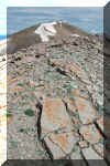 The summit of Point 13,676 had spectacular flat gray rocks with red
lichen. It looked like pictures from the surface of Mars.
The summit of Point 13,676 had spectacular flat gray rocks with red
lichen. It looked like pictures from the surface of Mars. |
 From the summit of Horseshoe you can clearly see (L - R) Mt. Sheridan,
Mt. Sherman and the white ridge.
From the summit of Horseshoe you can clearly see (L - R) Mt. Sheridan,
Mt. Sherman and the white ridge. |
 Another great view of Mt. Sherman looking across the red slopes of
Horseshoe.
Another great view of Mt. Sherman looking across the red slopes of
Horseshoe. |
 Eddie and Sheena on the summit.
 |
 Sheena heading back up and over Point 13,676 on the way back from
the summit. You can see the mine shack near the summit of Horseshoe.
Sheena heading back up and over Point 13,676 on the way back from
the summit. You can see the mine shack near the summit of Horseshoe. |
|
Ptarmigan Peak - 13,739 ft /4188
m elevation, 182.5th highest
This was the start of the climb to Horseshoe Mt. We can't believe
this is not a ranked peak. Eddie and Sheena climbed this 7/12/2013. |
 Eddie and Sheena on the summit of Ptarmigan.
 |
 From the summit of Ptarmigan Peak, you can see Point 13,717,
Horseshoe Mt. and Mt. Sherman (14,036').
From the summit of Ptarmigan Peak, you can see Point 13,717,
Horseshoe Mt. and Mt. Sherman (14,036'). |
 Sheena
coming down from the summit of Ptarmigan heading for Point 13,717. Sheena
coming down from the summit of Ptarmigan heading for Point 13,717. |
|
|
|
|
|
|
Sawatch
Range/Collegiate Peaks Area
Just
west of the Arkansas river, this is a stunning range with a range
of some of the most accessible peaks in central Colorado
|
Browns
Peak - 13,523 ft /4122 m elevation,
xxxth highest
Tagged Browns on the way to Huron. Not many photos due to bad weather. |
 The view of Browns from where I started the hike to Huron.
 |
 The view from the summit.
 |
|
Point
13,462 - 13,462 ft /4103 m elevation,
279th highest
Tagged this point on the way to Huron. Not many photos due to bad
weather. |
OK... no photo. I didn't realize until later that this point
was a listed summit. |
However, since it's on the ridge hike from Middle Mountain where I
started the hike to Huron, you can assume it was tagged. |
|
Middle
Mountain - 13xxx ft /4xxx m
After parking on the jeep trail below Middle Mountain, I worked up
the switch backs to the summit. From here I started my hike to Huron.
Not many photos due to bad weather. |
 Eddies
CJ7 Jeep parked at the start of the switch backs below the peak. Eddies
CJ7 Jeep parked at the start of the switch backs below the peak. |
 A view of Middle Mountain and the Jeep trail from the summit of Browns.
 |
|
Emerald
Peak - 13,904 ft elevation, 71st
highest
The first time Eddie saw this peak from Mt. Belford, he knew he had
to climb it. It is one of the most perfect looking peaks sitting by
itself out in the Missouri basin. |
 Eddie
and Sheena on the summit. Iowa and Missouri are in the background. Eddie
and Sheena on the summit. Iowa and Missouri are in the background. |
 The beautiful peak sitting in the Missouri basin.
 |
 A view of the peak from the camp site.
 |
Iowa
Peak - 13,831 ft m elevation, 91.5th
highest
In order to access Emerald and Iowa Peaks requires a backpacking trip
past 3 fourteeners, over the highest foot path in Colorado and into
the Missouri basin. |
 Sheena and Eddie on the summit.
 |
 Sheena
relaxing on the summit of Iowa with Emerald in the background. Sheena
relaxing on the summit of Iowa with Emerald in the background. |
 A view of Iowa (L) and Missouri (R) as seen from the summit of Emerald.
 |
Birthday Peak - 12,749 ft elevation
This peak sits on the south ridge of Mt. Harvard. Eddie hiked this
peak with Glen Marlin. Headed for Harvard, the trail was to crowded
so they opted for something else and wound up on this summit. Summited
9/2/90 |
Photos to come |
|
|


.JPG)