|

 Denver
Front Range Denver
Front Range
|
 Beaver
Brook Trail - The trail is probably one of the older front
range trails. It starts near Golden at Windy Point (7,049 ft) and
wanders it's way 9 miles to a trail head near Genese Park (7,414 ft).
This can be considered a difficult trail that with a lot of elevation
gain and loss (+- 1000 ft). It can be linked up with several other
trails including the Chavez trail.
 |
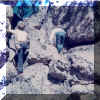 Hiking in the Denver foothills with Mark Bogert around 1972
 |
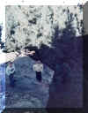 Mark (L) and Eddie (R) on our little cliff.
 |
|
 Maxwell Fall Trail - The trail head (Elevation - 7,800 ft.)
is
 |
 The Maxwell Falls cliffs where Eddie did his early learning to top-rope,
lead, boulder and solo.
 |
 The view of the cliffs from above the falls
 |
 Eddie's sister Juli and niece Sabrina at the falls on a spring day.
By fall, this slows to a trickle.
 |

|
 Candy and Conrad enjoying the trail.
 |
|
|
|
 Sharptail Ridge - The trail head (Elevation -TBD ft.) is
 |
|
|
|
|
|
|
|
|
|
 Waterton Canyon - The trail head (Elevation -TBD ft.) is
 |
 |
 The
head of Waterton Canyon and Segment 1 of the Colorado Trail. It's
also considered the end point for Segment 1 of the Highline Canal
Trail. The
head of Waterton Canyon and Segment 1 of the Colorado Trail. It's
also considered the end point for Segment 1 of the Highline Canal
Trail. |
 Typical traffic congestion in the canyon
 |
|
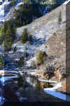
 The spill way in the winter (January 2020)
 |
 The spill way in the summer (June 2012)
 |
 Out with the Colorado Mountain Club (January 4, 2020)
 |
|
 Bear Creek Trail from Lair-o-the-Bear- The trail head (Elevation
- 6,450 ft.) is one of the more crowded trails in the front range,
but on a week day can still be enjoyable.
 |
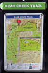 A
map of the trails around the park. A
map of the trails around the park. |
 Entrance
to Bear Creek Trail Entrance
to Bear Creek Trail |
 A
great Valentines day 2020 hike with the Colorado Mountain Club. A
great Valentines day 2020 hike with the Colorado Mountain Club. |
 Feb 14, 2020
 |
 Feb 14, 2020
 |
 The view from Panorama Point. About 4 miles from the trail head. The
view of the Mt. Evans group was spectacular this day.
 |
 The view from Panorama Point of the James Peak group.
 |
|
 South Valley Park Trail - The trail head (Elevation -TBD ft.)
is
 |
|
|
|
|
|
|
|
|
|
|

 Mount
Evans Region Mount
Evans Region
Just
West of Denver, this region was accessible from Eddie's first house
in about 45 minutes making it a great region to visit. With two
14'ers and a few other peaks we've spent plenty of time here. Eddie
has hiked Mt. Bierstadt over 20 times. Most of these trips done
while getting ready to climb Mt. Denali.
|
 Three
Mile Creek Trail #635 - A stunningly beautiful trail with
13 river crossings (bridges and logs) before heading up the slopes
toward Katake Mountain and joining the Rosalie trail. Three
Mile Creek Trail #635 - A stunningly beautiful trail with
13 river crossings (bridges and logs) before heading up the slopes
toward Katake Mountain and joining the Rosalie trail. |
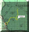 Click here for a map.
 |
 Three Mile Creek Trail in the Fall
 |
 Eddie on the Three Mile Creek trail
 |
 Three Mile Creek Trail in the Winter
 |
 Three Mile Creek in the Winter
 |
 Three Mile Creek in the Winter
 |
|
|
|
|
|
|
|
|
 Rosalie
Trail #603 - OK, we've never hiked the trail from Guenella
pass. We usually follow the Abyss Lake trail to the junction with
the Rosalie trail and then head South East. Rosalie
Trail #603 - OK, we've never hiked the trail from Guenella
pass. We usually follow the Abyss Lake trail to the junction with
the Rosalie trail and then head South East. |
 Click here for a map.
 |
 |
 Roselie Trail in the Mt. Evans wilderness area.
 |
|
|
|
|
|
|
 Abyss
Lake Trail #602 - The Abyss Lake Trail is a popular hiking
trail (Trail head elevation - 9,620 ft.), which terminates at Abyss
Lake. The lake is nestled in a high glacial cirque between Mt. Bierstadt
and Mt. Evans. The rocky slopes surrounding the lake are home to bighorn
sheep and mountain goats. Abyss
Lake Trail #602 - The Abyss Lake Trail is a popular hiking
trail (Trail head elevation - 9,620 ft.), which terminates at Abyss
Lake. The lake is nestled in a high glacial cirque between Mt. Bierstadt
and Mt. Evans. The rocky slopes surrounding the lake are home to bighorn
sheep and mountain goats. |
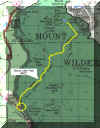 Click here for a map.
 |
 |
 Sheena at camp on the Abyss Lake trail.
 |
|
|
 Eddie at camp on the Abyss Lake trail in the Mt. Evans wilderness
area.
 |
|
|
|
|
|
|
|
|
|
|
 Burning
Bear Trail #601 - The trail head (Elevation - 9,620 ft.)
is approximately .2 mile west of the parking area for the Abyss
Trailhead. As it curves around the valley, it stays to the north
side of the slopes making this a great trail for skiing and snow
shoeing.
|
 |
|
|
|
|
|
|
|
|
|
 Herman
Gulch Trail #98 - The trail head (Elevation - 10,400 ft.)
is right off I70 at exit 218, three miles west of Bakerville. This
trail is popular for the spectacular alpine flowers in the spring.
|
 A view of our goal as we start out of the trees.
 |
 Sheena
and Candy bringing up the rear with their zest for gab. Sheena
and Candy bringing up the rear with their zest for gab. |
 Conrad
at our destination. Conrad
at our destination. |
 A little bit of the later (July) blooming alpine flowers
 |
 Candy and Conrad at the lake.
 |
 Sheena and Eddie at the lake.
 |
|
|
|
|
|
|
|
|
|
|
|
|
|
|
|
|
|
|
|
|
|
|
|
|
|
|
|
|
|
|
|

 Indian
Peaks Region/Wilderness Area Indian
Peaks Region/Wilderness Area
Just
West of Boulder, is the area that Eddie cut his hiking teeth on.
|
 Middle
St. Vrain Valley - Middle
St. Vrain Valley - |
|
|
|
|
|
|
|
|
|
|
|
|
|
|
|
 Hells
Valley - Hells
Valley - |
|
|
|
|
|
|
|
|
|
|
|
|
|
|
|
|
|
|
|
|
![]()
